
Comuna 5 - Castilla topographic map
Click on the map to display elevation.
About this map
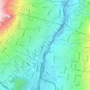
Name: Comuna 5 - Castilla topographic map, elevation, terrain.
Average elevation: 1,595 m
Minimum elevation: 1,432 m
Maximum elevation: 2,099 m
Other topographic maps
Click on a map to view its topography, its elevation and its terrain.
Parque del Barrio Alfonso Lopez
Colombia > Antioquia > Perímetro Urbano Medellín
Average elevation: 1,548 m
Parque de Los Pies Descalzos
Colombia > Antioquia > Perímetro Urbano Medellín
Average elevation: 1,485 m
Parque Biblioteca León de Greiff - La Ladera
Colombia > Antioquia > Perímetro Urbano Medellín
Average elevation: 1,595 m
Parque Biblioteca Presbítero José Luis Arroyave - San Javier
Colombia > Antioquia > Perímetro Urbano Medellín
Average elevation: 1,586 m