Geolocate

Sardinia topographic map

Click on the map to display elevation.

About this map

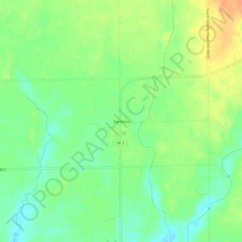
Name: Sardinia topographic map, elevation, terrain.

Location: Sardinia, Decatur County, Indiana, United States (39.13387 -85.65078 39.17387 -85.61078)

Average elevation: 234 m

Minimum elevation: 217 m

Maximum elevation: 255 m

Other topographic maps

Click on a map to view its topography, its elevation and its terrain.

Lake Santee

United States > Indiana > Decatur County

Average elevation: 307 m

St. Paul

United States > Indiana > Decatur County

Average elevation: 258 m

Westport

United States > Indiana > Decatur County

Average elevation: 249 m

Millhousen

United States > Indiana > Decatur County

Average elevation: 277 m

New Point

United States > Indiana > Decatur County

Average elevation: 301 m

Gear up for your next adventure:

🧣Merino Neck Gaiter - Protects against wind, sun, and cold at high altitudes
💧Reusable Water Bottle - Durable water bottles for hydration on trails
👟Leg Gaiters - Keep debris, mud, and snow out of your boots
🦌Outdoor Trail Camera - Monitor wildlife activity near your favorite spots
🚑Survival Whistle - Signal for help across long distances in mountains

As an Amazon Associate, this site earns from qualifying purchases at no extra cost to you.