Geolocate

Raco topographic map

Click on the map to display elevation.

About this map

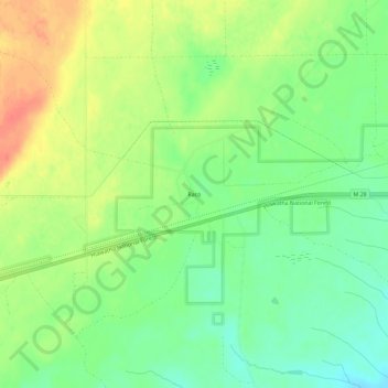
Name: Raco topographic map, elevation, terrain.

Location: Raco, Superior Township, Chippewa County, Michigan, United States (46.35557 -84.74284 46.39557 -84.70284)

Average elevation: 256 m

Minimum elevation: 233 m

Maximum elevation: 284 m

Other topographic maps

Click on a map to view its topography, its elevation and its terrain.

Soo Township

United States > Michigan > Chippewa County

Average elevation: 200 m

Sugar Island

United States > Michigan > Chippewa County

Average elevation: 194 m

Lake Huron

United States > Michigan > Chippewa County

Average elevation: 183 m

Gear up for your next adventure:

Backpacking Tent - Lightweight tent for long-distance hiking trips
🪑Ultralight Camping Stool - Compact seating for rest stops during long hikes
Camping Coffee Maker - Brew fresh coffee anywhere on the topographic map
Camping Groundsheet - Protect your tent from moisture and dirt
🍽️Titanium Camping Spork - Ultralight and indestructible eating utensil

As an Amazon Associate, this site earns from qualifying purchases at no extra cost to you.