Geolocate

Kansai topographic map

Click on the map to display elevation.

About this map

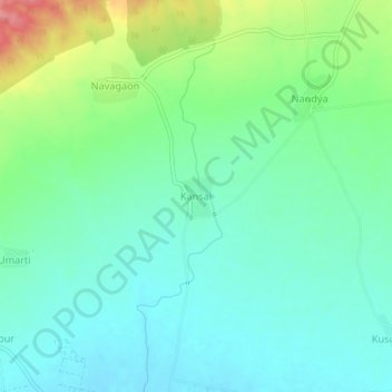
Name: Kansai topographic map, elevation, terrain.

Location: Kansai, Shahade, Nandurbar, Maharashtra, India (21.66261 74.39330 21.70261 74.43330)

Average elevation: 211 m

Minimum elevation: 182 m

Maximum elevation: 286 m

Gear up for your next adventure:

🧴Waterproofing Spray - Restore the DWR coating on jackets and tents
💧Collapsible Water Bottle - Space-saving water bottle for outdoor activities
🧦Merino Wool Socks - Moisture-wicking comfort for long-distance hiking
🚑Survival Whistle - Signal for help across long distances in mountains
🧳Compression Sacks - Maximize space in your backpack by shrinking gear

As an Amazon Associate, this site earns from qualifying purchases at no extra cost to you.