Geolocate

Arvada topographic map

Click on the map to display elevation.

About this map

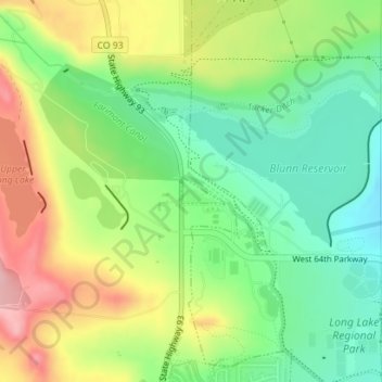
Name: Arvada topographic map, elevation, terrain.

Location: Arvada, Jefferson County, Colorado, United States (39.82002 -105.22167 39.82199 -105.21766)

Average elevation: 1,796 m

Minimum elevation: 1,731 m

Maximum elevation: 1,887 m

Gear up for your next adventure:

🐕Hiking Dog Pack - Let your canine companion carry their own water and food
🧢Hiking Hat - Sun-protective and breathable hats for long treks
🔋Lithium AA Batteries - Long-lasting power that performs in extreme cold
🛏️Camping Sleeping Mat - Comfortable mats for sleeping outdoors
🔨Vehicle Emergency Tool - Safety tool for remote road trips to trailheads

As an Amazon Associate, this site earns from qualifying purchases at no extra cost to you.