Geolocate

Shenandoah Farms topographic map

Click on the map to display elevation.

About this map

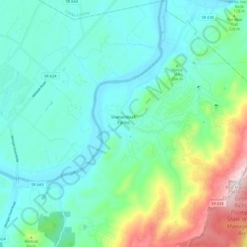
Name: Shenandoah Farms topographic map, elevation, terrain.

Location: Shenandoah Farms, Warren County, Virginia, United States (38.93477 -78.08864 39.01958 -78.00431)

Average elevation: 250 m

Minimum elevation: 124 m

Maximum elevation: 668 m

Gear up for your next adventure:

🥾Hiking Shoes - Durable and comfortable shoes for trail hiking
🥾Mountain Hiking Shoes - Shoes with superior grip for mountainous terrain
🧼Travel Hand Sanitizer - Keep hands clean when water is scarce
🥾Hiking Leggings - Comfortable leggings for outdoor activities
👟Leg Gaiters - Keep debris, mud, and snow out of your boots

As an Amazon Associate, this site earns from qualifying purchases at no extra cost to you.