
Thank you for supporting this site ❤️
Make a donation
Make a donation
Gear up for your next adventure:
As an Amazon Associate, this site earns from qualifying purchases at no extra cost to you.
Mollem topographic map
Click on the map to display elevation.
Thank you for supporting this site ❤️
Make a donation
Make a donation
Gear up for your next adventure:
As an Amazon Associate, this site earns from qualifying purchases at no extra cost to you.
About this map
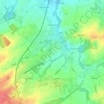
Name: Mollem topographic map, elevation, terrain.
Location: Mollem, Asse, Hal-Vilvorde, Brabant flamand, Belgique (50.90952 4.20004 50.94446 4.25254)
Average elevation: 50 m
Minimum elevation: 27 m
Maximum elevation: 86 m
Thank you for supporting this site ❤️
Make a donation
Make a donation
Gear up for your next adventure:
As an Amazon Associate, this site earns from qualifying purchases at no extra cost to you.