Geolocate

Findhorn topographic map

Click on the map to display elevation.

About this map

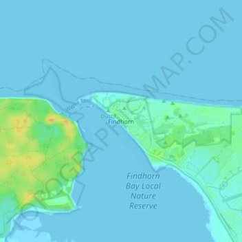
Name: Findhorn topographic map, elevation, terrain.

Location: Findhorn, Moray, Scotland, IV36 3YG, United Kingdom (57.63911 -3.63070 57.67911 -3.59070)

Average elevation: 3 m

Minimum elevation: -1 m

Maximum elevation: 24 m

Gear up for your next adventure:

🗺️Topographic Maps - Detailed maps to explore trails, mountains, and wilderness areas
🧥Softshell Jacket - Windproof and breathable jacket for hiking
🥾Mountain Hiking Shoes - Shoes with superior grip for mountainous terrain
🧤Rechargeable Heated Gloves - Extreme warmth for Canadian winter expeditions
🧥Waterproof Jacket - Lightweight rain jackets for hiking and outdoor activities

As an Amazon Associate, this site earns from qualifying purchases at no extra cost to you.