Geolocate

Wilburn topographic map

Click on the map to display elevation.

About this map

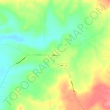
Name: Wilburn topographic map, elevation, terrain.

Location: Wilburn, Cleburne County, Arkansas, 72179, United States (35.48730 -91.90820 35.52730 -91.86820)

Average elevation: 124 m

Minimum elevation: 86 m

Maximum elevation: 174 m

Other topographic maps

Click on a map to view its topography, its elevation and its terrain.

Heber Springs

United States > Arkansas > Cleburne County

Average elevation: 152 m

Quitman

United States > Arkansas > Cleburne County

Average elevation: 197 m

Greers Ferry

United States > Arkansas > Cleburne County

Average elevation: 162 m

Higden

United States > Arkansas > Cleburne County

Average elevation: 152 m

Gear up for your next adventure:

🔪Outdoor Multitool - Versatile tool for repairs and food prep in the wild
🧴Bear Spray Holster - Quick-access carry for essential Canadian wilderness safety
🧴Sunscreen SPF - Broad-spectrum sunscreen for outdoor activities
Camping Groundsheet - Protect your tent from moisture and dirt
🥫Freeze-Dried Meals - Lightweight, high-calorie nutrition for multi-day treks

As an Amazon Associate, this site earns from qualifying purchases at no extra cost to you.