Geolocate

Könnern topographic map

Click on the map to display elevation.

About this map

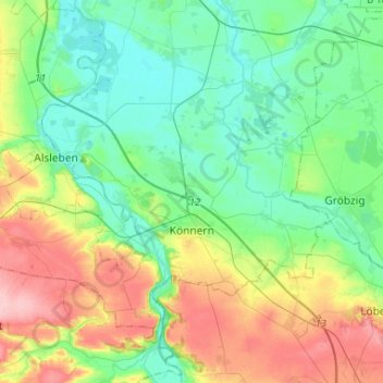
Name: Könnern topographic map, elevation, terrain.

Location: Könnern, Salzlandkreis, Saxony-Anhalt, Germany (51.62882 11.60371 51.74483 11.86555)

Average elevation: 101 m

Minimum elevation: 59 m

Maximum elevation: 192 m

Other topographic maps

Click on a map to view its topography, its elevation and its terrain.

Lust

Germany > Saxony-Anhalt > Salzlandkreis > Staßfurt

Average elevation: 71 m

Cochstedt

Germany > Saxony-Anhalt > Salzlandkreis

Average elevation: 135 m

Gear up for your next adventure:

🧢Hiking Sun Hat - Wide-brimmed protection for exposed mountain ridges
🧰Survival Kit - Essential gear for emergencies in the wilderness
🛶Waterproof Dry Bags - Keep electronics and clothes dry during river crossings
🧢Beanie Hat - Keep your head warm in cold weather
💧Hydration Pack - Hands-free hydration system for long hikes

As an Amazon Associate, this site earns from qualifying purchases at no extra cost to you.