Geolocate

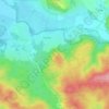
Kamberk topographic map

Click on the map to display elevation.

About this map

Name: Kamberk topographic map, elevation, terrain.

Location: Kamberk, okres Benešov, Central Bohemian Region, Central Bohemia, Czechia (49.57508 14.80722 49.62115 14.86984)

Average elevation: 448 m

Minimum elevation: 382 m

Maximum elevation: 565 m

Other topographic maps

Click on a map to view its topography, its elevation and its terrain.

Studce

Czechia > Central Bohemian Region

Average elevation: 235 m

Trojhran

Czechia > Central Bohemian Region > Žehrov

Average elevation: 285 m

Mezivrata

Czechia > Central Bohemian Region > Neustupov

Average elevation: 630 m

Gear up for your next adventure:

🥾Lightweight Hiking Shoes - Comfortable shoes for day hikes
🥾Hiking Shoes - Durable and comfortable shoes for trail hiking
🔦UV Flashlight - Detect minerals or specific insects in the dark
🥾Waterproof Hiking Shoes - Durable shoes for wet and rugged trails
🧰Survival Kit - Essential gear for emergencies in the wilderness

As an Amazon Associate, this site earns from qualifying purchases at no extra cost to you.