
Qikiqtaaluk topographic map
Interactive map
Click on the map to display elevation.
About this map
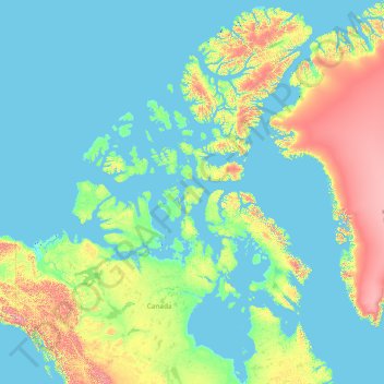
Name: Qikiqtaaluk topographic map, elevation, terrain.
Location: Qikiqtaaluk, Nunavut, Canada (51.16073 -110.00331 83.33621 -59.61368)
Average elevation: 373 m
Minimum elevation: -3 m
Maximum elevation: 4,429 m
Other topographic maps
Click on a map to view its topography, its elevation and its terrain.