Geolocate

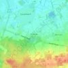
Niederlangen topographic map

Click on the map to display elevation.

About this map

Name: Niederlangen topographic map, elevation, terrain.

Location: Niederlangen, Samtgemeinde Lathen, Landkreis Emsland, Nedersaksen, 49779, Duitsland (52.84626 7.15851 52.89088 7.31006)

Average elevation: 11 m

Minimum elevation: 3 m

Maximum elevation: 39 m

Other topographic maps

Click on a map to view its topography, its elevation and its terrain.

Gleesen

Duitsland > Nedersaksen > Landkreis Emsland

Average elevation: 29 m

Neusustrum

Duitsland > Nedersaksen > Landkreis Emsland

Average elevation: 11 m

Hesselte

Duitsland > Nedersaksen > Landkreis Emsland > Emsbüren

Average elevation: 31 m

Sprakel

Duitsland > Nedersaksen > Landkreis Emsland > Stavern

Average elevation: 39 m

Sand

Duitsland > Nedersaksen > Landkreis Emsland > Oberlangen

Average elevation: 10 m

Haar

Duitsland > Nedersaksen > Landkreis Emsland > Haren (Ems)

Average elevation: 15 m

Gear up for your next adventure:

🥾Light Trekking Boots - Supportive boots for multi-day treks
🛰️Satellite Messenger - Emergency communication for areas with no cell service
🧴Insect Repellent - Protect yourself from bugs during outdoor adventures
🧥Softshell Hiking Jacket - The perfect balance of wind protection and breathability
🧦Outdoor Socks - Durable socks designed for hiking and outdoor sports

As an Amazon Associate, this site earns from qualifying purchases at no extra cost to you.