
Thank you for supporting this site ❤️
Make a donation
Make a donation
Gear up for your next adventure:
As an Amazon Associate, this site earns from qualifying purchases at no extra cost to you.
Darb Es Sim topographic map
Click on the map to display elevation.
Thank you for supporting this site ❤️
Make a donation
Make a donation
Gear up for your next adventure:
As an Amazon Associate, this site earns from qualifying purchases at no extra cost to you.
About this map
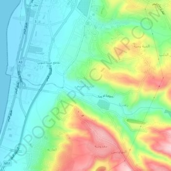
Name: Darb Es Sim topographic map, elevation, terrain.
Location: Darb Es Sim, Sidon District, South Governorate, 1600, Lebanon (33.51430 35.36203 33.55430 35.40203)
Average elevation: 82 m
Minimum elevation: 0 m
Maximum elevation: 251 m
Thank you for supporting this site ❤️
Make a donation
Make a donation
Gear up for your next adventure:
As an Amazon Associate, this site earns from qualifying purchases at no extra cost to you.