Geolocate

Wirowongso topographic map

Click on the map to display elevation.

About this map

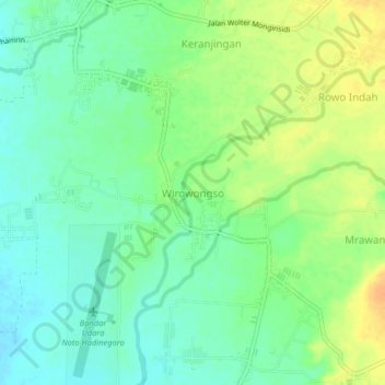
Name: Wirowongso topographic map, elevation, terrain.

Location: Wirowongso, Jember, East Java, Indonesia (-8.24985 113.68421 -8.20985 113.72421)

Average elevation: 87 m

Minimum elevation: 73 m

Maximum elevation: 107 m

Gear up for your next adventure:

🧊Portable Cooler - Keep food and drinks cold during outdoor adventures
🧭GPS Handheld Device - Reliable GPS navigation for outdoor adventures
🗺️Topographic Maps - Detailed maps to explore trails, mountains, and wilderness areas
🎒Hiking Daypack - Lightweight and durable backpacks for day trips and excursions
🛁Quick-Dry Microfiber Towel - Space-saving towel that dries rapidly on the move

As an Amazon Associate, this site earns from qualifying purchases at no extra cost to you.