
Make a donation
Gear up for your next adventure:
As an Amazon Associate, this site earns from qualifying purchases at no extra cost to you.
Saint-Paul topographic map
Click on the map to display elevation.
Make a donation
Gear up for your next adventure:
As an Amazon Associate, this site earns from qualifying purchases at no extra cost to you.
Saint-Paul
Le territoire communal est le plus vaste du département. Il recouvre une partie du cirque de Mafate et son point culminant se trouve tout près du sommet du Gros Morne, à 3 019 m d'altitude. Un autre sommet se trouve aux frontières de la commune : le Grand Bénare, qui culmine à 2 898 m d'altitude.
Make a donation
Gear up for your next adventure:
As an Amazon Associate, this site earns from qualifying purchases at no extra cost to you.
About this map
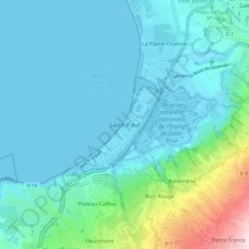
Name: Saint-Paul topographic map, elevation, terrain.
Location: Saint-Paul, La Réunion, 97460, France (-21.04061 55.23716 -20.96061 55.31716)
Average elevation: 131 m
Minimum elevation: 0 m
Maximum elevation: 868 m
Make a donation
Gear up for your next adventure:
As an Amazon Associate, this site earns from qualifying purchases at no extra cost to you.