Geolocate

Jessup topographic map

Click on the map to display elevation.

About this map

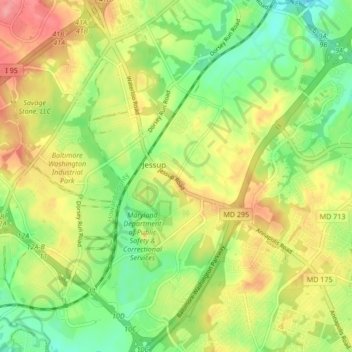
Name: Jessup topographic map, elevation, terrain.

Location: Jessup, Anne Arundel County, Maryland, United States (39.11422 -76.81190 39.17977 -76.75334)

Average elevation: 65 m

Minimum elevation: 22 m

Maximum elevation: 117 m

Other topographic maps

Click on a map to view its topography, its elevation and its terrain.

Gear up for your next adventure:

🧭Orienteering Kit - Tools for map reading and navigation in the wild
🍽️Titanium Camping Spork - Ultralight and indestructible eating utensil
🛌Down Sleeping Bag - Superior warmth-to-weight ratio for cold nights
🥽Outdoor Goggles - Protective eyewear for outdoor activities
🥾Mountain Hiking Shoes - Shoes with superior grip for mountainous terrain

As an Amazon Associate, this site earns from qualifying purchases at no extra cost to you.