Geolocate

Pechón topographic map

Click on the map to display elevation.

About this map

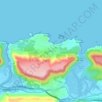
Name: Pechón topographic map, elevation, terrain.

Location: Pechón, Val de San Vicente, Cantabria, 39594, Spain (43.37027 -4.50921 43.41027 -4.46921)

Average elevation: 41 m

Minimum elevation: -8 m

Maximum elevation: 223 m

Gear up for your next adventure:

🕶️Polarized Sunglasses - Protect your eyes with durable polarized lenses
🧰Emergency Multi-Tool - Compact multi-tool for outdoor survival
🛌Insulated Sleeping Pad - Critical thermal barrier between you and the cold ground
🥾Trail Running Boots - Durable shoes designed for trail running
🔪Outdoor Multitool - Versatile tool for repairs and food prep in the wild

As an Amazon Associate, this site earns from qualifying purchases at no extra cost to you.