
Thank you for supporting this site ❤️
Make a donation
Make a donation
Gear up for your next adventure:
As an Amazon Associate, this site earns from qualifying purchases at no extra cost to you.
Wardin topographic map
Click on the map to display elevation.
Thank you for supporting this site ❤️
Make a donation
Make a donation
Gear up for your next adventure:
As an Amazon Associate, this site earns from qualifying purchases at no extra cost to you.
About this map
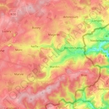
Name: Wardin topographic map, elevation, terrain.
Location: Wardin, Bastenaken, Luxemburg, Wallonië, 6600, België (49.95827 5.72106 50.04020 5.84014)
Average elevation: 487 m
Minimum elevation: 363 m
Maximum elevation: 557 m
Thank you for supporting this site ❤️
Make a donation
Make a donation
Gear up for your next adventure:
As an Amazon Associate, this site earns from qualifying purchases at no extra cost to you.