
Thank you for supporting this site ❤️
Make a donation
Make a donation
Gear up for your next adventure:
As an Amazon Associate, this site earns from qualifying purchases at no extra cost to you.
Hochheim topographic map
Click on the map to display elevation.
Thank you for supporting this site ❤️
Make a donation
Make a donation
Gear up for your next adventure:
As an Amazon Associate, this site earns from qualifying purchases at no extra cost to you.
About this map
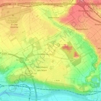
Name: Hochheim topographic map, elevation, terrain.
Location: Hochheim, Main-Taunus-Kreis, Hesse, 65239, Germany (49.99706 8.33019 50.05813 8.41276)
Average elevation: 123 m
Minimum elevation: 81 m
Maximum elevation: 167 m
Thank you for supporting this site ❤️
Make a donation
Make a donation
Gear up for your next adventure:
As an Amazon Associate, this site earns from qualifying purchases at no extra cost to you.