
Thank you for supporting this site ❤️
Make a donation
Make a donation
Gear up for your next adventure:
As an Amazon Associate, this site earns from qualifying purchases at no extra cost to you.
Saint-Guy topographic map
Click on the map to display elevation.
Thank you for supporting this site ❤️
Make a donation
Make a donation
Gear up for your next adventure:
As an Amazon Associate, this site earns from qualifying purchases at no extra cost to you.
About this map
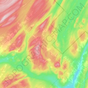
Name: Saint-Guy topographic map, elevation, terrain.
Location: Saint-Guy, Les Basques, Bas-Saint-Laurent, Quebec, Canada (47.95045 -68.86102 48.12958 -68.65919)
Average elevation: 297 m
Minimum elevation: 156 m
Maximum elevation: 478 m
Les Basques trails, hiking, mountain biking, running and outdoor activities
Thank you for supporting this site ❤️
Make a donation
Make a donation
Gear up for your next adventure:
As an Amazon Associate, this site earns from qualifying purchases at no extra cost to you.