
Thank you for supporting this site ❤️
Make a donation
Make a donation
Gear up for your next adventure:
As an Amazon Associate, this site earns from qualifying purchases at no extra cost to you.
Fravica topographic map
Click on the map to display elevation.
Thank you for supporting this site ❤️
Make a donation
Make a donation
Gear up for your next adventure:
As an Amazon Associate, this site earns from qualifying purchases at no extra cost to you.
About this map
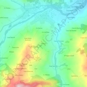
Name: Fravica topographic map, elevation, terrain.
Location: Fravica, Pianello Val Tidone, Piacenza, Emilia-Romagna, Italia (44.91440 9.38450 44.95440 9.42450)
Average elevation: 285 m
Minimum elevation: 155 m
Maximum elevation: 578 m
Thank you for supporting this site ❤️
Make a donation
Make a donation
Gear up for your next adventure:
As an Amazon Associate, this site earns from qualifying purchases at no extra cost to you.