
Thank you for supporting this site ❤️
Make a donation
Make a donation
Gear up for your next adventure:
As an Amazon Associate, this site earns from qualifying purchases at no extra cost to you.
Casahuala topographic map
Click on the map to display elevation.
Thank you for supporting this site ❤️
Make a donation
Make a donation
Gear up for your next adventure:
As an Amazon Associate, this site earns from qualifying purchases at no extra cost to you.
About this map
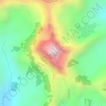
Name: Casahuala topographic map, elevation, terrain.
Location: Casahuala, San Fernando, Ambato, Tungurahua, Ecuador (-1.16018 -78.78177 -1.16008 -78.78167)
Average elevation: 4,078 m
Minimum elevation: 3,793 m
Maximum elevation: 4,500 m
Thank you for supporting this site ❤️
Make a donation
Make a donation
Gear up for your next adventure:
As an Amazon Associate, this site earns from qualifying purchases at no extra cost to you.