Geolocate

Buntong topographic map

Click on the map to display elevation.

About this map

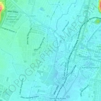
Name: Buntong topographic map, elevation, terrain.

Location: Buntong, Ipoh, Kinta, Perak, 30100, Malaysia (4.57771 101.04430 4.61771 101.08430)

Average elevation: 46 m

Minimum elevation: 33 m

Maximum elevation: 142 m

Other topographic maps

Click on a map to view its topography, its elevation and its terrain.

Sungai Pinji

Malaysia > Perak > Ipoh

Average elevation: 101 m

Ipoh Padang

Malaysia > Perak > Ipoh > Buntong > Kampung Kuchai

Average elevation: 43 m

Eco Park 2

Malaysia > Perak > Ipoh

Average elevation: 53 m

Kampung Baru Simpang Pulai

Malaysia > Perak > Ipoh

Average elevation: 54 m

Geopark Lubuk Timah

Malaysia > Perak > Ipoh

Average elevation: 131 m

Kampung Jawa

Malaysia > Perak > Ipoh

Average elevation: 45 m

Mirror lake

Malaysia > Perak > Ipoh

Average elevation: 80 m

Kampung Simee

Malaysia > Perak > Ipoh > Kampung Simee

Average elevation: 54 m

Taman Permainan

Malaysia > Perak > Ipoh

Average elevation: 72 m

Gear up for your next adventure:

🥾Mountaineering Boots - Supportive boots for climbing and high-altitude hiking
🌬️Windproof Camp Stove - Efficient cooking even on exposed mountain peaks
Camping Groundsheet - Protect your tent from moisture and dirt
🚲Handlebar Phone Mount - View topographic-map.com live while cycling
🥾Hiking Shoes - Durable and comfortable shoes for trail hiking

As an Amazon Associate, this site earns from qualifying purchases at no extra cost to you.