Geolocate

Appalachia topographic map

Click on the map to display elevation.

About this map

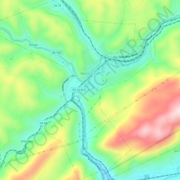
Name: Appalachia topographic map, elevation, terrain.

Location: Appalachia, Wise County, Virginia, 24216, United States (36.89498 -82.81340 36.92129 -82.76525)

Average elevation: 615 m

Minimum elevation: 485 m

Maximum elevation: 893 m

Gear up for your next adventure:

Lightweight Backpacking Tent - Compact tent for efficient hiking trips
🛶Kayak Dry Bag - Waterproof storage for kayaking adventures
🔋Solar Power Bank - Keep your GPS and devices charged during long outdoor trips
🥾Waterproof Hiking Shoes - Durable shoes for wet and rugged trails
🧣Evaporative Cooling Towel - Beat the heat during intense summer climbs

As an Amazon Associate, this site earns from qualifying purchases at no extra cost to you.