
Make a donation
Gear up for your next adventure:
As an Amazon Associate, this site earns from qualifying purchases at no extra cost to you.
Tijucas topographic map
Click on the map to display elevation.
Make a donation
Gear up for your next adventure:
As an Amazon Associate, this site earns from qualifying purchases at no extra cost to you.
Tijucas
Tijucas é um município brasileiro do estado de Santa Catarina. Localiza-se a uma latitude 27º14'29" sul e a uma longitude 48º38'01" oeste, estando a uma altitude de 2 metros. Sua população estimada em 2019 é de 38.407 habitantes. Possui uma área de 278,91 quilômetros quadrados.
Make a donation
Gear up for your next adventure:
As an Amazon Associate, this site earns from qualifying purchases at no extra cost to you.
About this map
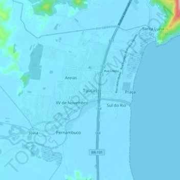
Name: Tijucas topographic map, elevation, terrain.
Average elevation: 8 m
Minimum elevation: -3 m
Maximum elevation: 299 m
Make a donation
Gear up for your next adventure:
As an Amazon Associate, this site earns from qualifying purchases at no extra cost to you.