
Make a donation
Gear up for your next adventure:
As an Amazon Associate, this site earns from qualifying purchases at no extra cost to you.
Hemelrijk topographic map
Click on the map to display elevation.
Make a donation
Gear up for your next adventure:
As an Amazon Associate, this site earns from qualifying purchases at no extra cost to you.
Hemelrijk
Denderleeuw en het gehucht Leeuwbrug ontwikkelden zich in een hoefijzervorm langs de Dender, die ter hoogte van Denderleeuw van richting verandert. Het gebied van Hemelrijk bleef lang een landelijk gebied op het plateau ten westen van de Dender.
Make a donation
Gear up for your next adventure:
As an Amazon Associate, this site earns from qualifying purchases at no extra cost to you.
About this map
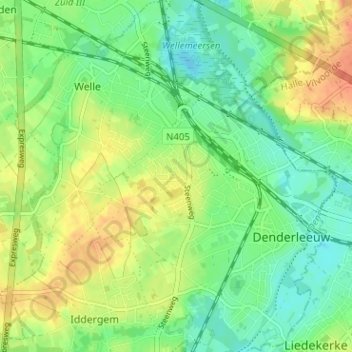
Name: Hemelrijk topographic map, elevation, terrain.
Average elevation: 20 m
Minimum elevation: 3 m
Maximum elevation: 43 m
Make a donation
Gear up for your next adventure:
As an Amazon Associate, this site earns from qualifying purchases at no extra cost to you.