Geolocate

sa Riera topographic map

Click on the map to display elevation.

About this map

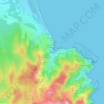
Name: sa Riera topographic map, elevation, terrain.

Location: sa Riera, Begur, Bajo Ampurdán, Gerona, Cataluña, 17213, España (41.95250 3.18977 41.99250 3.22977)

Average elevation: 66 m

Minimum elevation: -3 m

Maximum elevation: 246 m

Other topographic maps

Click on a map to view its topography, its elevation and its terrain.

Gear up for your next adventure:

🧴Insect Repellent - Protect yourself from bugs during outdoor adventures
🧊Portable Cooler - Keep food and drinks cold during outdoor adventures
🪑Ultralight Camping Stool - Compact seating for rest stops during long hikes
🪜Heavy Duty Carabiners - Multi-use clips for securing gear to your backpack
Camping Coffee Maker - Brew fresh coffee anywhere on the topographic map

As an Amazon Associate, this site earns from qualifying purchases at no extra cost to you.