Geolocate

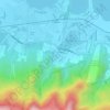
Bucal topographic map

Click on the map to display elevation.

About this map

Name: Bucal topographic map, elevation, terrain.

Location: Bucal, Calamba, Laguna, Calabarzon, 4027, Philippines (14.17756 121.15973 14.19520 121.18570)

Average elevation: 38 m

Minimum elevation: 0 m

Maximum elevation: 172 m

Other topographic maps

Click on a map to view its topography, its elevation and its terrain.
Bucal

Philippines > Laguna > Calamba

Average elevation: 22 m

88 Spa & Resort

Philippines > Laguna > Calamba

Average elevation: 83 m

ASN Ph2 Park

Philippines > Laguna > Calamba

Average elevation: 133 m

Bucal Reservoir

Philippines > Laguna > Calamba

Average elevation: 42 m

Calamba Town Plaza

Philippines > Laguna > Calamba

Average elevation: 11 m

Casa de Palmera Resort

Philippines > Laguna > Calamba

Average elevation: 49 m

Gear up for your next adventure:

🥾Mountain Hiking Shoes - Shoes with superior grip for mountainous terrain
⛺Camping Essentials - All-in-one gear for a comfortable camping trip
💧Collapsible Water Bottle - Space-saving water bottle for outdoor activities
🥾Hiking Gaiters - Protect legs and shoes from mud, snow, and debris
🛁Quick-Dry Microfiber Towel - Space-saving towel that dries rapidly on the move

As an Amazon Associate, this site earns from qualifying purchases at no extra cost to you.