Geolocate

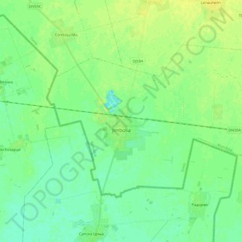
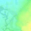
Jimbolia topographic map

Click on the map to display elevation.

Jimbolia

Jimbolia is located in the west of Timiș County, 39 km from Timișoara, with which it is connected by the county road 59A and the Kikinda–Jimbolia–Timișoara railway. It lies in the Banat Plain, at the contact between the Timiș Plain and the Mureș Plain. An alignment of villages marks the boundary between the two relief units: Checea–Cărpiniș–Satchinez. The average altitude of the town is 82 m. It is located at the intersection of some roads that connect Romania and Serbia, being also a rail and road border point at the frontier between the two countries.

Wikipedia (CC-BY-SA 3.0)

About this map

Name: Jimbolia topographic map, elevation, terrain.

Location: Jimbolia, Timiș, 305400, Romania (45.74893 20.65092 45.84548 20.86977)

Average elevation: 80 m

Minimum elevation: 73 m

Maximum elevation: 89 m

Other topographic maps

Click on a map to view its topography, its elevation and its terrain.

Cadar

Romania > Timiș

Average elevation: 129 m

Vizejdia

Romania > Timiș

Average elevation: 86 m

Crivobara

Romania > Timiș

Average elevation: 181 m

Bunea Mare

Romania > Timiș > Făget

Average elevation: 206 m

Lugoj

Romania > Timiș

The territory of Lugoj belongs to the high plain of Lugoj and the hills of Lugoj. Located in the contact area of these units, the city developed on the lower terrace of the Timiș River, on both its banks. The relief unit in which Lugoj is located is the Lugoj Plain, which penetrates deep into the piedmont…

Average elevation: 166 m
Banat

Romania > Timiș > Recaș

Average elevation: 296 m

Honorici

Romania > Timiș

Average elevation: 164 m

Gladna Montană

Romania > Timiș

Average elevation: 299 m

Botanic Park

Romania > Timiș > Timișoara

Average elevation: 93 m

Bodo

Romania > Timiș

Average elevation: 131 m

Colonia Fabricii

Romania > Timiș

Average elevation: 405 m

Groși

Romania > Timiș

Average elevation: 259 m

Sălciua Nouă

Romania > Timiș

Average elevation: 191 m

Remetea Mică

Romania > Timiș

Average elevation: 156 m

Drinova

Romania > Timiș

Average elevation: 239 m

Blajova

Romania > Timiș

Average elevation: 111 m

Gear up for your next adventure:

🚲Bike Repair Kit - Essential tools for on-trail mechanical issues
💡Portable Camping Lamp - Rechargeable lamp for campsite lighting
🥾Light Hiking Boots - Lightweight and comfortable boots for day hikes
🥾Light Trekking Boots - Supportive boots for multi-day treks
🥾Trail Hiking Shoes - Durable shoes designed for rugged trails

As an Amazon Associate, this site earns from qualifying purchases at no extra cost to you.