Geolocate

Gamleby topographic map

Click on the map to display elevation.

About this map

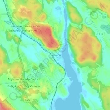
Name: Gamleby topographic map, elevation, terrain.

Location: Gamleby, Västerviks kommun, Kalmar County, 594 31, Sweden (57.87982 16.38826 57.91982 16.42826)

Average elevation: 26 m

Minimum elevation: -5 m

Maximum elevation: 82 m

Gear up for your next adventure:

🥾Mountain Trail Shoes - High-traction shoes for mountain trails
🧭GPS Tracker - Track your location in remote areas safely
🔋Lithium AA Batteries - Long-lasting power that performs in extreme cold
🚲Handlebar Phone Mount - View topographic-map.com live while cycling
🧶550 Survival Paracord - Versatile utility cord for emergency repairs and rigging

As an Amazon Associate, this site earns from qualifying purchases at no extra cost to you.