Geolocate

Glassmanor topographic map

Click on the map to display elevation.

About this map

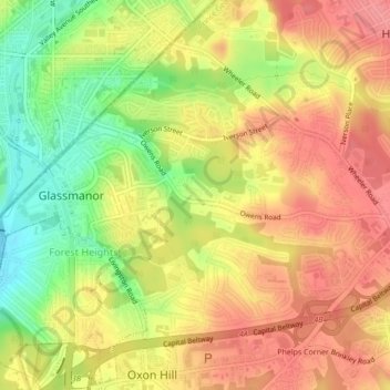
Name: Glassmanor topographic map, elevation, terrain.

Location: Glassmanor, Prince George's County, Maryland, United States (38.80585 -77.00570 38.83213 -76.96273)

Average elevation: 53 m

Minimum elevation: 1 m

Maximum elevation: 90 m

Gear up for your next adventure:

📷Outdoor Action Camera - Capture high-elevation views and rugged adventures
🛁Quick-Dry Microfiber Towel - Space-saving towel that dries rapidly on the move
🧦Crew Hiking Socks - Comfortable socks for long-distance hikes
🥾Mountain Hiking Boots - High-traction boots for rocky terrain
🥾Lightweight Hiking Boots - Boots for comfort and mobility on long hikes

As an Amazon Associate, this site earns from qualifying purchases at no extra cost to you.