Geolocate

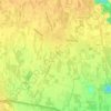
Carità topographic map

Click on the map to display elevation.

About this map

Name: Carità topographic map, elevation, terrain.

Location: Carità, Villorba, Province of Treviso, Veneto, 31020, Italy (45.69199 12.23871 45.73199 12.27871)

Average elevation: 26 m

Minimum elevation: 16 m

Maximum elevation: 37 m

Other topographic maps

Click on a map to view its topography, its elevation and its terrain.

Spresiano

Italy > Veneto > Province of Treviso

Average elevation: 48 m

Arcade

Italy > Veneto > Province of Treviso

Average elevation: 58 m

Montebelluna

Italy > Veneto > Province of Treviso

The territory of Montebelluna is largely flat, with altitudes ranging from 69 m a.s.l., found south of San Gaetano, to 144 m, north of Pederiva. The landscape is also characterized by the presence of two hills, including the western end of Montello (where the maximum altitude is, 343 m) and the more modest…

Average elevation: 124 m
Treviso

Italy > Veneto > Province of Treviso

Average elevation: 16 m

Vittorio Veneto

Italy > Veneto > Province of Treviso

Average elevation: 525 m

Asolo

Italy > Veneto > Province of Treviso

Average elevation: 132 m

Conegliano

Italy > Veneto > Province of Treviso

Average elevation: 94 m

Refrontolo

Italy > Veneto > Province of Treviso

Average elevation: 176 m

Vidor

Italy > Veneto > Province of Treviso

Average elevation: 164 m

Possagno

Italy > Veneto > Province of Treviso

Average elevation: 586 m

Gear up for your next adventure:

🦶Anti-Blister Balm - Prevents friction and hotspots during long ascents
🪜Heavy Duty Carabiners - Multi-use clips for securing gear to your backpack
👟Leg Gaiters - Keep debris, mud, and snow out of your boots
🥾Waterproof Trail Shoes - Shoes designed to handle wet terrain
🔦UV Flashlight - Detect minerals or specific insects in the dark

As an Amazon Associate, this site earns from qualifying purchases at no extra cost to you.