Geolocate

Lagos del Sol topographic map

Click on the map to display elevation.

About this map
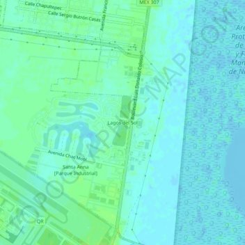
Name: Lagos del Sol topographic map, elevation, terrain.

Location: Lagos del Sol, Cancún, Benito Juárez, Quintana Roo, 77569, Mexico (21.03559 -86.86932 21.07559 -86.82932)

Average elevation: 4 m

Minimum elevation: -4 m

Maximum elevation: 9 m

Other topographic maps

Click on a map to view its topography, its elevation and its terrain.

Distrito 1

Mexico > Quintana Roo > Cancún

Average elevation: 6 m

Distrito 1

Mexico > Quintana Roo > Cancún

Average elevation: 6 m

Distrito 11

Mexico > Quintana Roo > Cancún

Average elevation: 8 m

Gear up for your next adventure:

🧴Sunscreen SPF - Broad-spectrum sunscreen for outdoor activities
🥾Trail Hiking Shoes - Durable shoes designed for rugged trails
🔨Vehicle Emergency Tool - Safety tool for remote road trips to trailheads
🔋Emergency Crank Radio - Weather alerts and power without needing batteries
🧭Orienteering Kit - Tools for map reading and navigation in the wild

As an Amazon Associate, this site earns from qualifying purchases at no extra cost to you.