Geolocate

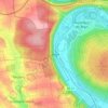
Kitzingen topographic map

Click on the map to display elevation.

About this map

Name: Kitzingen topographic map, elevation, terrain.

Location: Kitzingen, Landkreis Kitzingen, Bavaria, Germany (49.70390 10.09087 49.79088 10.23102)

Average elevation: 234 m

Minimum elevation: 180 m

Maximum elevation: 318 m

Other topographic maps

Click on a map to view its topography, its elevation and its terrain.
Euerfeld

Germany > Bavaria > Landkreis Kitzingen > Dettelbach

Average elevation: 276 m

Enheim

Germany > Bavaria > Landkreis Kitzingen

Average elevation: 290 m

Köhler

Germany > Bavaria > Landkreis Kitzingen > Volkach

Average elevation: 252 m

Langenberg

Germany > Bavaria > Landkreis Kitzingen

Average elevation: 399 m

Gear up for your next adventure:

🧥Waterproof Jacket - Lightweight rain jackets for hiking and outdoor activities
⛺Lightweight Camping Tent - Portable shelter optimized for Canadian backcountry camping
🧊Insulated Water Bottle - Keeps drinks cold in summer and prevents freezing in winter
🥾Waterproof Trail Shoes - Shoes designed to handle wet terrain
🦶Anti-Blister Balm - Prevents friction and hotspots during long ascents

As an Amazon Associate, this site earns from qualifying purchases at no extra cost to you.