Geolocate

Colors topographic map

Click on the map to display elevation.

About this map

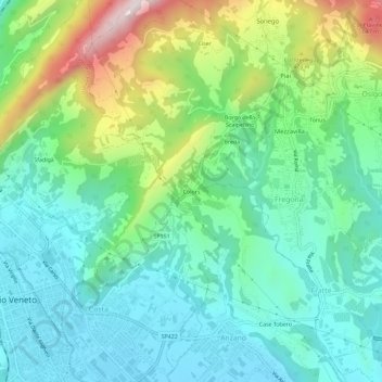
Name: Colors topographic map, elevation, terrain.

Location: Colors, Fregona, Treviso, Veneto, 31029, Italy (45.98101 12.30427 46.02101 12.34427)

Average elevation: 288 m

Minimum elevation: 115 m

Maximum elevation: 731 m

Gear up for your next adventure:

🏕️Camping Hammock - Integrated protection for sleeping between trees
🥾Mountain Hiking Boots - High-traction boots for rocky terrain
💡LED Headlamp - Hands-free illumination for night hiking and camping
🥾All-Terrain Hiking Boots - Versatile boots for varied hiking conditions
Tent Footprint - Protect tent floor and increase durability

As an Amazon Associate, this site earns from qualifying purchases at no extra cost to you.