Geolocate

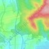
Echzell topographic map

Click on the map to display elevation.

About this map

Name: Echzell topographic map, elevation, terrain.

Location: Echzell, Wetteraukreis, Hesse, 61209, Germany (50.35615 8.83904 50.41971 8.95736)

Average elevation: 153 m

Minimum elevation: 118 m

Maximum elevation: 254 m

Other topographic maps

Click on a map to view its topography, its elevation and its terrain.

Der Haag

Germany > Hesse > Wetteraukreis > Melbach

Average elevation: 155 m

Kreischberg

Germany > Hesse > Wetteraukreis > Büdingen

Average elevation: 213 m

Gear up for your next adventure:

🦟Insect Repellent - Keep mosquitoes and black flies away in wooded areas
🥾Mountaineering Boots - Supportive boots for climbing and high-altitude hiking
🥾Lightweight Hiking Boots - Boots for comfort and mobility on long hikes
🛏️Sleeping Bag - Warm and compact sleeping bags for outdoor camping
🧢Hiking Sun Hat - Wide-brimmed protection for exposed mountain ridges

As an Amazon Associate, this site earns from qualifying purchases at no extra cost to you.