Geolocate

Wolfshagen topographic map

Click on the map to display elevation.

About this map
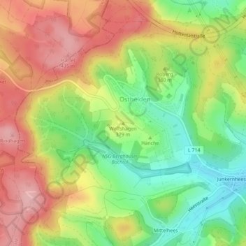
Name: Wolfshagen topographic map, elevation, terrain.

Location: Wolfshagen, Kreuztal, Kreis Siegen-Wittgenstein, Noordrijn-Westfalen, 57223, Duitsland (50.95816 7.94133 50.95826 7.94143)

Average elevation: 370 m

Minimum elevation: 295 m

Maximum elevation: 445 m

Other topographic maps

Click on a map to view its topography, its elevation and its terrain.

Gear up for your next adventure:

🔪Outdoor Multitool - Versatile tool for repairs and food prep in the wild
🧴First Aid Kit - Essential first aid supplies for outdoor emergencies
🛁Quick-Dry Microfiber Towel - Space-saving towel that dries rapidly on the move
🔋Lithium AA Batteries - Long-lasting power that performs in extreme cold
🥾Light Hiking Boots - Lightweight and comfortable boots for day hikes

As an Amazon Associate, this site earns from qualifying purchases at no extra cost to you.