
Thank you for supporting this site ❤️
Make a donation
Make a donation
Gear up for your next adventure:
As an Amazon Associate, this site earns from qualifying purchases at no extra cost to you.
Tamgaly topographic map
Click on the map to display elevation.
Thank you for supporting this site ❤️
Make a donation
Make a donation
Gear up for your next adventure:
As an Amazon Associate, this site earns from qualifying purchases at no extra cost to you.
About this map
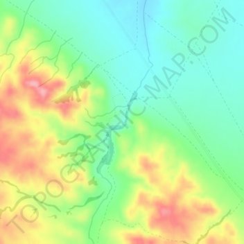
Name: Tamgaly topographic map, elevation, terrain.
Location: Tamgaly, Zhambyl District, Almaty Region, Kazakhstan (43.79409 75.52632 43.81409 75.54632)
Average elevation: 907 m
Minimum elevation: 862 m
Maximum elevation: 975 m
Thank you for supporting this site ❤️
Make a donation
Make a donation
Gear up for your next adventure:
As an Amazon Associate, this site earns from qualifying purchases at no extra cost to you.