
Tâmna topographic map
Interactive map
Click on the map to display elevation.
About this map
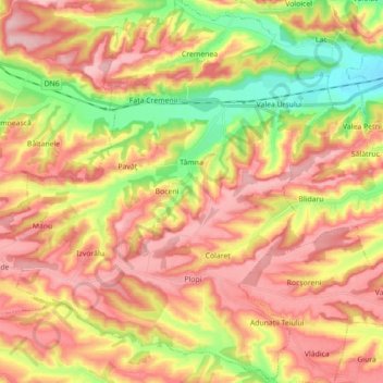
Name: Tâmna topographic map, elevation, terrain.
Location: Tâmna, Mehedinți, Rumänien (44.49884 22.91980 44.62438 23.08003)
Average elevation: 268 m
Minimum elevation: 162 m
Maximum elevation: 352 m