Geolocate

Olaga topographic map

Click on the map to display elevation.

About this map

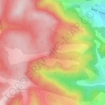
Name: Olaga topographic map, elevation, terrain.

Location: Olaga, Goñi, Comarca de Pamplona, Navarra, España (42.82789 -1.92639 42.84789 -1.90639)

Average elevation: 1,019 m

Minimum elevation: 801 m

Maximum elevation: 1,137 m

Gear up for your next adventure:

🎒Backpack Rain Cover - External shield to keep your entire pack dry
Family Camping Tent - Spacious tent suitable for family camping trips
🔭Outdoor Binoculars - Lightweight binoculars for birdwatching and hiking
🥾Hiking Shoes - Durable and comfortable shoes for trail hiking
🔦UV Flashlight - Detect minerals or specific insects in the dark

As an Amazon Associate, this site earns from qualifying purchases at no extra cost to you.