Geolocate

Amba topographic map

Click on the map to display elevation.

About this map
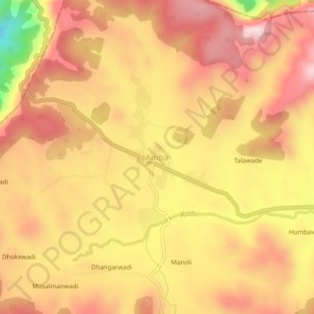
Name: Amba topographic map, elevation, terrain.

Location: Amba, Shahuwadi, Kolhapur District, Maharashtra, India (16.95133 73.77797 16.99133 73.81797)

Average elevation: 619 m

Minimum elevation: 332 m

Maximum elevation: 778 m

Other topographic maps

Click on a map to view its topography, its elevation and its terrain.

Panhala Fort

India > Maharashtra > Shahuwadi > Panhala

Average elevation: 825 m

Panhala Fort

India > Maharashtra > Shahuwadi > Panhala

Average elevation: 825 m

Gear up for your next adventure:

👟Sport Hiking Sandals - Breathable footwear for water crossings and camp rest
🔪Outdoor Multitool - Versatile tool for repairs and food prep in the wild
🥤Collapsible Travel Cup - Saves space and weight in your mess kit
🚲Heavy Duty Bike Lock - Secure your bike at the trailhead or during stops
🛁Quick-Dry Microfiber Towel - Space-saving towel that dries rapidly on the move

As an Amazon Associate, this site earns from qualifying purchases at no extra cost to you.