Geolocate

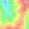
Recanto Tropical topographic map

Click on the map to display elevation.

About this map

Name: Recanto Tropical topographic map, elevation, terrain.

Location: Recanto Tropical, Cascavel, Paraná, Região Sul, Brasil (-24.94860 -53.50099 -24.91513 -53.47772)

Average elevation: 693 m

Minimum elevation: 641 m

Maximum elevation: 750 m

Other topographic maps

Click on a map to view its topography, its elevation and its terrain.
Alto Alegre

Brasil > Paraná > Cascavel

Average elevation: 717 m

Rio do Salto

Brasil > Paraná > Cascavel

Average elevation: 634 m

Lago

Brasil > Paraná > Cascavel

Average elevation: 745 m

Cascavel

Brasil > Paraná > Cascavel

Consideravelmente novo e com topografia privilegiada, teve seu desenvolvimento planejado, o que lhe deu ruas largas e bairros bem distribuídos, com o quarto melhor planejamento e urbanismo do país, de acordo com o Ranking Connected Smart Cities 2020.

Average elevation: 677 m

São João d'Oeste

Brasil > Paraná > Cascavel

Average elevation: 704 m

São Martin

Brasil > Paraná > Cascavel

Average elevation: 675 m

Rio do Salto

Brasil > Paraná > Cascavel > Rio do Salto

Average elevation: 610 m

Gear up for your next adventure:

🧢Hiking Hat - Sun-protective and breathable hats for long treks
🧊Insulated Water Bottle - Keeps drinks cold in summer and prevents freezing in winter
⛺Tent Footprint - Protect tent floor and increase durability
🚲MTB Frame Bag - Carry tools and maps directly on your bicycle frame
🥾Trail Hiking Socks - Comfortable socks to prevent blisters and fatigue

As an Amazon Associate, this site earns from qualifying purchases at no extra cost to you.