Geolocate

Whitehall topographic map

Click on the map to display elevation.

About this map

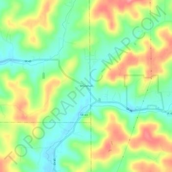
Name: Whitehall topographic map, elevation, terrain.

Location: Whitehall, Owen County, Indiana, United States (39.15428 -86.70441 39.19428 -86.66441)

Average elevation: 235 m

Minimum elevation: 195 m

Maximum elevation: 289 m

Other topographic maps

Click on a map to view its topography, its elevation and its terrain.

Gosport

United States > Indiana > Owen County

Average elevation: 184 m

Spencer

United States > Indiana > Owen County

Average elevation: 178 m

Gear up for your next adventure:

🐕Hiking Dog Pack - Let your canine companion carry their own water and food
🧢Hiking Sun Hat - Wide-brimmed protection for exposed mountain ridges
🔨Vehicle Emergency Tool - Safety tool for remote road trips to trailheads
🧥Waterproof Hiking Jacket - Protect yourself from rain and wind while hiking
Lightweight Camping Tent - Portable shelter optimized for Canadian backcountry camping

As an Amazon Associate, this site earns from qualifying purchases at no extra cost to you.