Geolocate

Fanzolo topographic map

Click on the map to display elevation.

About this map

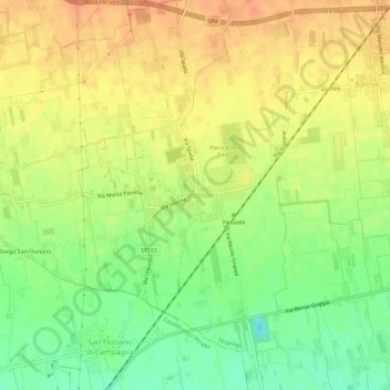
Name: Fanzolo topographic map, elevation, terrain.

Location: Fanzolo, Vedelago, Fonte, Treviso, Veneto, Italy (45.69036 11.96619 45.73036 12.00619)

Average elevation: 60 m

Minimum elevation: 35 m

Maximum elevation: 78 m

Gear up for your next adventure:

🥾Trail Hiking Boots - Supportive boots for rough trails
🥾Light Hiking Boots - Lightweight and comfortable boots for day hikes
🚲Handlebar Phone Mount - View topographic-map.com live while cycling
🎒Backpack Rain Cover - External shield to keep your entire pack dry
🔭Compact Monocular - One-handed bird watching and trail spotting

As an Amazon Associate, this site earns from qualifying purchases at no extra cost to you.