Geolocate

Yamy topographic map

Click on the map to display elevation.

About this map

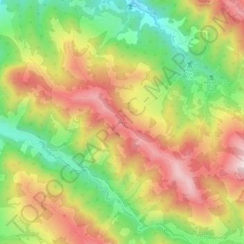
Name: Yamy topographic map, elevation, terrain.

Location: Yamy, Ust-Putyla Rural Hromada, Vyzhnytsia Raion, Chernivtsi Oblast, 59111, Ukraine (48.13548 25.10814 48.17548 25.14814)

Average elevation: 660 m

Minimum elevation: 405 m

Maximum elevation: 913 m

Other topographic maps

Click on a map to view its topography, its elevation and its terrain.

Dumeny

Ukraine > Chernivtsi Oblast

Average elevation: 122 m

Chernivtsi

Ukraine > Chernivtsi Oblast

The city is located in a temperate climate zone. The climate is continental with mild winters and warm summers. The average annual temperature is +8.6 °C (47.5 °F), the lowest in January (−2.9 °C; 26.8 °F), the highest – in July (+19.8 °C; 67.6 °F). Winter weather usually comes on 28 November and…

Average elevation: 226 m

Vashkivtsi

Ukraine > Chernivtsi Oblast

Average elevation: 227 m

Chernivtsi

Ukraine > Chernivtsi Oblast

The city is located in a temperate climate zone. The climate is continental with mild winters and warm summers. The average annual temperature is +8,6 °C (47 °F), the lowest in January (-2,9 °C; 27 °F), the highest – in July (+19,8 °C; 68 °F). Winter weather usually comes on 28 November and ends 9…

Average elevation: 226 m

Andrekivske

Ukraine > Chernivtsi Oblast

Average elevation: 1,052 m

Verkhnii Yalovets

Ukraine > Chernivtsi Oblast

Average elevation: 1,133 m

Khotyn

Ukraine > Chernivtsi Oblast

Average elevation: 206 m

Gear up for your next adventure:

🦟Insect Repellent - Keep mosquitoes and black flies away in wooded areas
🔥Camping Stove - Portable stoves to cook outdoors with ease
Backpacking Tent - Lightweight tent for long-distance hiking trips
Lightweight Camping Tent - Portable shelter optimized for Canadian backcountry camping
💡Solar Camping Lamp - Eco-friendly lighting for campsites

As an Amazon Associate, this site earns from qualifying purchases at no extra cost to you.