Geolocate

McCoy topographic map

Click on the map to display elevation.

About this map

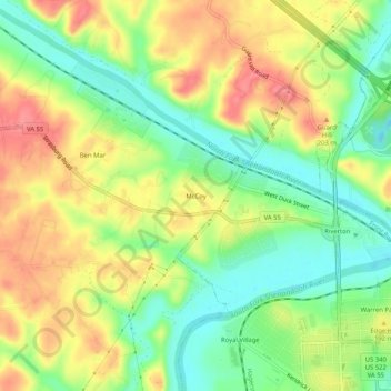
Name: McCoy topographic map, elevation, terrain.

Location: McCoy, Warren County, Virginia, 22649, United States (38.93011 -78.23806 38.97011 -78.19806)

Average elevation: 175 m

Minimum elevation: 137 m

Maximum elevation: 216 m

Gear up for your next adventure:

Backpacking Tent - Lightweight tent for long-distance hiking trips
🧦Crew Hiking Socks - Comfortable socks for long-distance hikes
Lightweight Camping Tent - Portable shelter optimized for Canadian backcountry camping
Bushcraft Tarp - Versatile emergency shelter or gear protection
🧥Insulated Jacket - Keep warm in cold outdoor conditions

As an Amazon Associate, this site earns from qualifying purchases at no extra cost to you.