Geolocate

Dittersbach topographic map

Click on the map to display elevation.

About this map

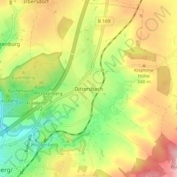
Name: Dittersbach topographic map, elevation, terrain.

Location: Dittersbach, Frankenberg/Sachsen, Mittelsachsen, Sachsen, 09669, Deutschland (50.91024 13.04746 50.95024 13.08746)

Average elevation: 322 m

Minimum elevation: 252 m

Maximum elevation: 396 m

Other topographic maps

Click on a map to view its topography, its elevation and its terrain.

Gear up for your next adventure:

🧭GPS Tracker - Track your location in remote areas safely
🛌Down Sleeping Bag - Superior warmth-to-weight ratio for cold nights
🧴Insect Repellent - Protect yourself from bugs during outdoor adventures
🥾Waterproof Hiking Boots - Boots keeping your feet dry in wet conditions
🦌Outdoor Trail Camera - Monitor wildlife activity near your favorite spots

As an Amazon Associate, this site earns from qualifying purchases at no extra cost to you.