Geolocate

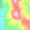
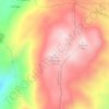
Arbo topographic map

Click on the map to display elevation.

About this map

Name: Arbo topographic map, elevation, terrain.

Location: Arbo, Paradanta, Pontevedra, Galicia, España (42.08374 -8.37186 42.15742 -8.25559)

Average elevation: 285 m

Minimum elevation: 8 m

Maximum elevation: 949 m

Other topographic maps

Click on a map to view its topography, its elevation and its terrain.

As Pereiras

España > Galicia > Paradanta

Average elevation: 222 m

Monte Pedroso

España > Galicia > Paradanta > La Cañiza

Average elevation: 834 m

Maceira

España > Galicia > Paradanta

Average elevation: 496 m

O Touredo

España > Galicia > Paradanta > La Cañiza

Average elevation: 460 m

Cebreiro

España > Galicia > Paradanta > La Cañiza

Average elevation: 603 m

Monte Vieiro

España > Galicia > Paradanta > A Porteliña

Average elevation: 546 m

Montes da Paradanta

España > Galicia > Paradanta > A Cañiza

Average elevation: 614 m

O Faro de Avión

España > Galicia > Paradanta > Covelo

Average elevation: 985 m

Pico San Felipe

España > Galicia > Paradanta

Average elevation: 400 m

Serra do Suído

España > Galicia > Paradanta

Average elevation: 917 m

Rozas

España > Galicia > Paradanta

Average elevation: 153 m

Rebordechán

España > Galicia > Paradanta

Average elevation: 712 m

Paravedra

España > Galicia > Paradanta

Average elevation: 291 m

Cebreiro

España > Galicia > Paradanta > La Cañiza

Average elevation: 603 m

Gear up for your next adventure:

🥽Outdoor Goggles - Protective eyewear for outdoor activities
🩹Compact First Aid Kit - Pre-packed essentials for common trail injuries
🗺️Topographic Maps - Detailed maps to explore trails, mountains, and wilderness areas
🥾Hiking Shorts - Breathable shorts suitable for summer hikes
🛌Down Sleeping Bag - Superior warmth-to-weight ratio for cold nights

As an Amazon Associate, this site earns from qualifying purchases at no extra cost to you.