Geolocate

Puente Paucartambo topographic map

Click on the map to display elevation.

About this map

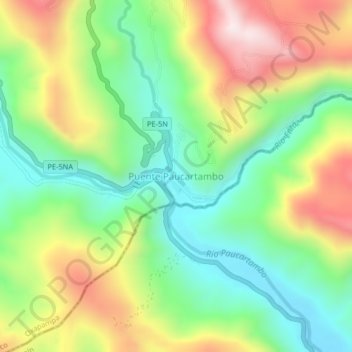
Name: Puente Paucartambo topographic map, elevation, terrain.

Location: Puente Paucartambo, Villa Rica, Oxapampa, Pasco, Perú (-10.85832 -75.30876 -10.81832 -75.26876)

Average elevation: 1,004 m

Minimum elevation: 737 m

Maximum elevation: 1,403 m

Gear up for your next adventure:

🥾Approach Boots - Comfortable boots for hiking and climbing approaches
🥾Trail Running Shoes - Lightweight and durable shoes for trail running
🛌Down Sleeping Bag - Superior warmth-to-weight ratio for cold nights
Camping Essentials - All-in-one gear for a comfortable camping trip
🪜Heavy Duty Carabiners - Multi-use clips for securing gear to your backpack

As an Amazon Associate, this site earns from qualifying purchases at no extra cost to you.